Blog Layout
Wilberfoss Flood Map
Sarah Wills • Nov 17, 2023
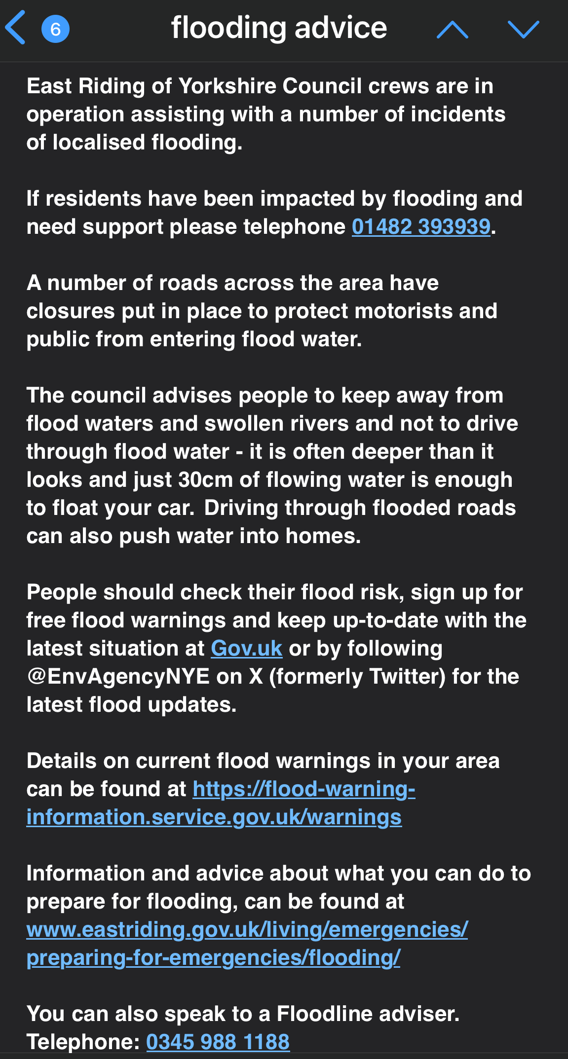
Check your flood risk
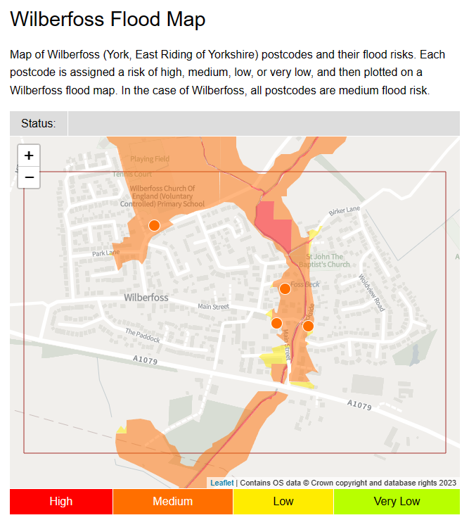
Wilberfoss Flood Map (getthedata.com) Please be aware that East Riding of Yorkshire Council no longer provides sandbags to individual homeowners. It is the responsibility of a homeowner to do their best to mitigate flooding at their property. For help during a flood, please click the link below 'Flooding advice and useful telephone numbers and links'
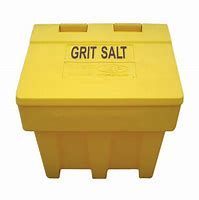
Use the interactive map to report a salt bin that needs re-filling.

Use your smartphone camera to scan the QR code below. In addition follow our WhatsApp Channel for news and alerts by clicking the link in this blog.
Work will begin on the 18th March 2024 and last 4-6 weeks
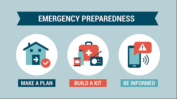
Be prepared in advance of any emergency

Please follow the link below

Every contribution is valuable
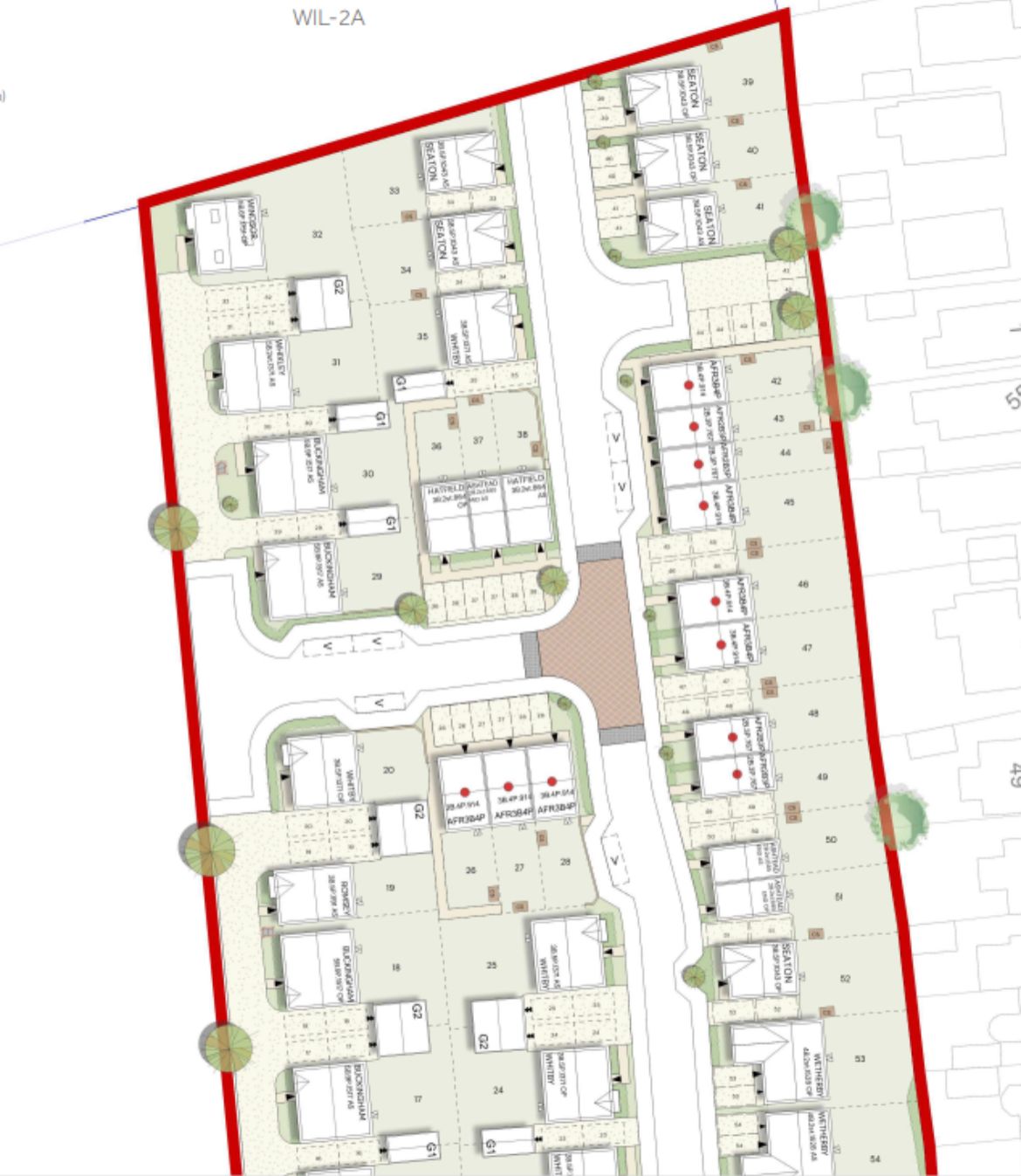
Please follow the link below to the full planning application and relevant documents 23/02292/STPLF | Erection of 69 dwellings, open space, landscaping and associated infrastructure | Land South Of Mill Farm Mill Lane Wilberfoss East Riding Of Yorkshire YO41 5NJ

A list of tasks that will be carried out over the coming months

Diary of regular activities - there's something for everyone!